The Humble Church Sampler and the Future of Snow Science in a Warming American West
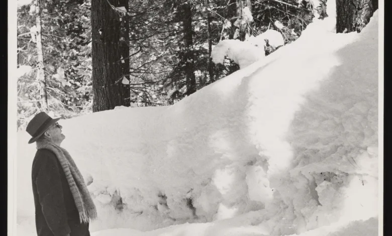
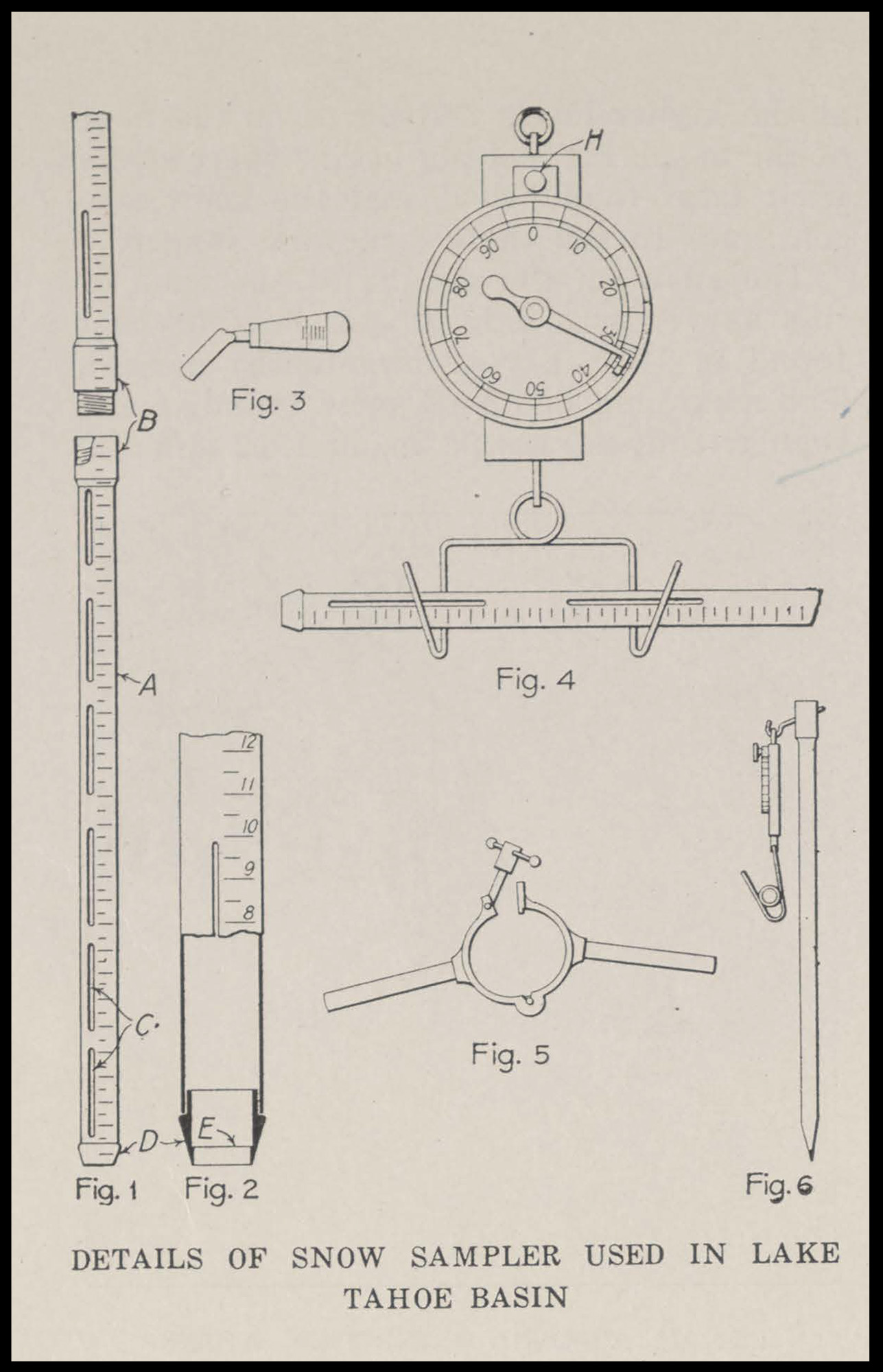
On a frigid morning in February, Toby Rodgers, a hydrologist for the U.S. Department of Agriculture’s Natural Resources Conservation Service (NRCS), navigated the rugged terrain of Washington’s Cascade Mountains on snowshoes. He carried with him a piece of equipment that seemed more like a relic of the industrial age than a modern scientific instrument: a long, hollow aluminum tube tipped with a sharp, serrated steel bit. This device, known as the Church Sampler, is the cornerstone of a century-old practice that remains the most reliable method for predicting the water supply of the American West.
When Rodgers reached a designated sampling site, he drove the tube through the snowpack until it struck the frozen earth beneath. By extracting a vertical core of snow and weighing it on a specialized spring scale, Rodgers could determine the "snow water equivalent" (SWE). This measurement does not merely track the depth of the snow; it calculates exactly how much liquid water will be released into the rivers, lakes, and reservoirs downstream when the spring thaw begins. Despite the advent of satellites and automated sensors, this manual process remains the "ground truth" for water management in a region where every drop is contested.

The Genesis of Snow Science: From Classics to Climate
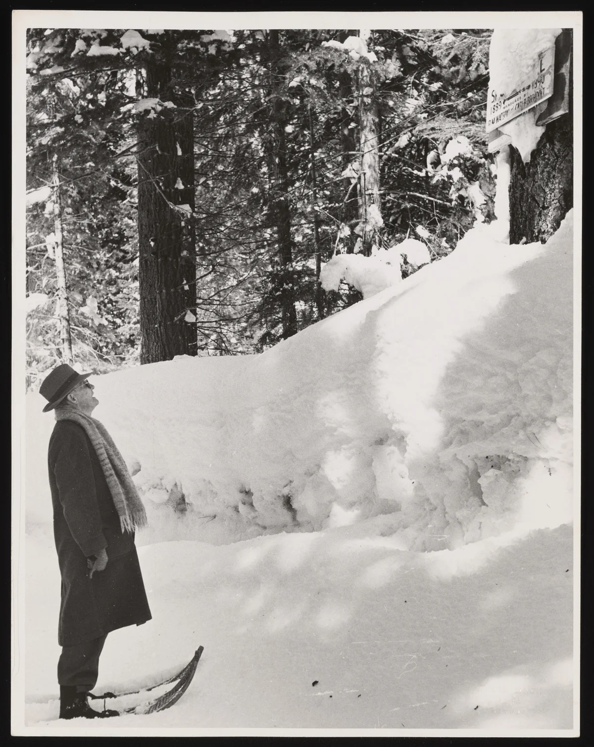
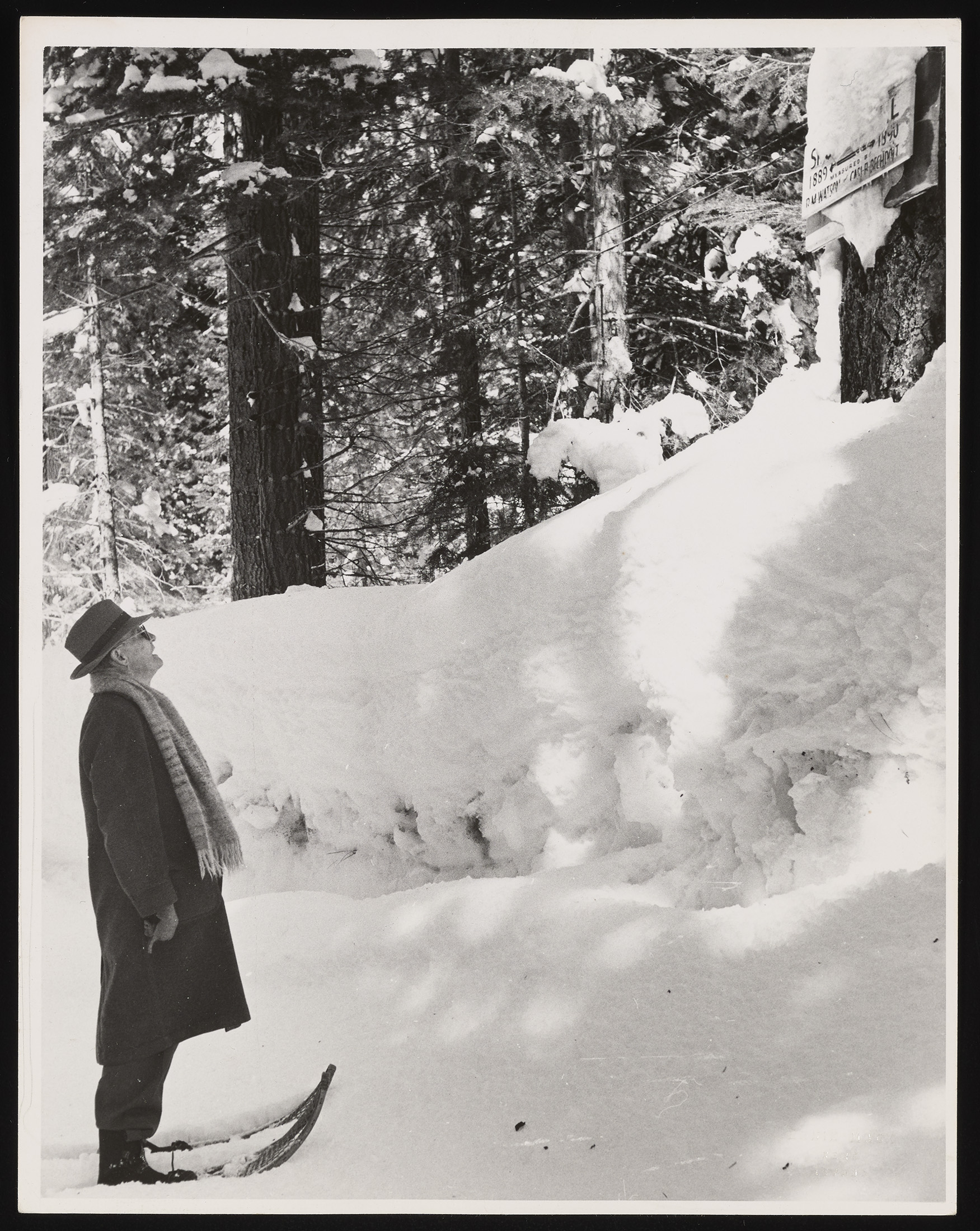
The history of the Church Sampler is as improbable as the device is simple. It was invented in the early 1900s by James Church, a professor of Latin and Greek at the University of Nevada, Reno. While his professional life was dedicated to the classics, his passion lay in the winter peaks of the Sierra Nevada. At the turn of the 20th century, the West was undergoing a period of rapid expansion. Agriculture, mining, and growing municipalities were all beginning to strain the limits of the region’s natural water cycles.
Church recognized a critical gap in the era’s infrastructure: while engineers knew how much water was in the reservoirs, they had no way of knowing how much was "stored" in the mountains as snow. In 1906, he established the Mount Rose Weather Observatory. Through trial and error, he developed the Mount Rose Sampler—later renamed the Church Sampler—to measure the density and water content of snow.
His realization was revolutionary: by measuring the weight of the snowpack at specific locations year after year, he could create a predictive model for summer streamflows. This allowed farmers to plan their crops and city planners to manage their reserves. The success of his measurements above Lake Tahoe eventually caught the attention of state and federal authorities, leading to the creation of the Federal-State Cooperative Snow Survey in the 1930s.
The Mechanics of the "Ground Truth"
To understand why the Church Sampler persists in the age of artificial intelligence, one must understand the physics of snow. Snow is not a uniform substance; it can be light and "dry" or heavy and "wet" (often referred to by hydrologists as "Sierra Cement"). A ten-foot snowpack of light powder might contain less water than a four-foot snowpack of dense, compacted slush.
The Church Sampler bypasses the ambiguity of depth. The weight of the snow core captured in the tube is directly proportional to its water content. One inch of weight on the scale equals one inch of water on the ground. Snow scientists like Rodgers use a specialized tool, often compared to a high-tech butter knife, to scrape away dirt and debris from the bottom of the core to ensure the weight reflects only the frozen precipitation.
While the NRCS now operates a vast network of automated SNOTEL (Snow Telemetry) stations—which use "snow pillows" filled with antifreeze to weigh snowpack automatically—manual surveys remain essential. Manual sites, many of which have been visited monthly for over a hundred years, provide a long-term historical record that automated sensors cannot yet match. Furthermore, manual sampling allows scientists to calibrate automated data and account for local variations in terrain and wind.
A Chronology of Snow Science and Water Management
The evolution of water forecasting in the West has followed a distinct timeline of technological and bureaucratic milestones:
- 1906: James Church establishes the Mount Rose Weather Observatory, marking the birth of snow science.
- 1910: The first formal snow surveys are conducted in the Sierra Nevada to resolve water disputes between power companies and farmers.
- 1935: The U.S. Department of Agriculture (USDA) establishes a formal federal snow survey program in response to the devastating Dust Bowl droughts.
- 1970s: The introduction of the SNOTEL system begins, automating data collection at remote high-altitude sites.
- 2000s: Satellite imagery and LiDAR (Light Detection and Ranging) begin to provide basin-wide views of snow cover.
- 2020s: Climate change introduces "snow droughts," where traditional historical patterns no longer predict future runoff with the same accuracy.
The 2026 Snow Drought and Its Implications
The importance of Rodgers’ work has been underscored by the volatile weather patterns of the mid-2020s. In 2026, the American West faced what scientists categorize as a "snow drought." This phenomenon occurs when total precipitation may be near normal, but warmer temperatures cause that precipitation to fall as rain rather than snow, or cause the snow to melt prematurely.
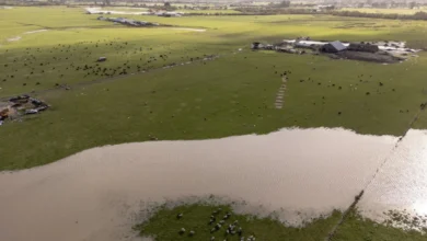
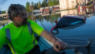
On April 1, 2026—the date traditionally used by hydrologists to mark the peak of the winter snowpack—the data was alarming. In parts of California and the Desert Southwest, snow levels were recorded at just 17 percent of their historical averages. In Washington’s Stevens Pass, where Rodgers conducted his surveys, the winter saw significant precipitation, but much of it arrived in the form of "rain-on-snow" events.
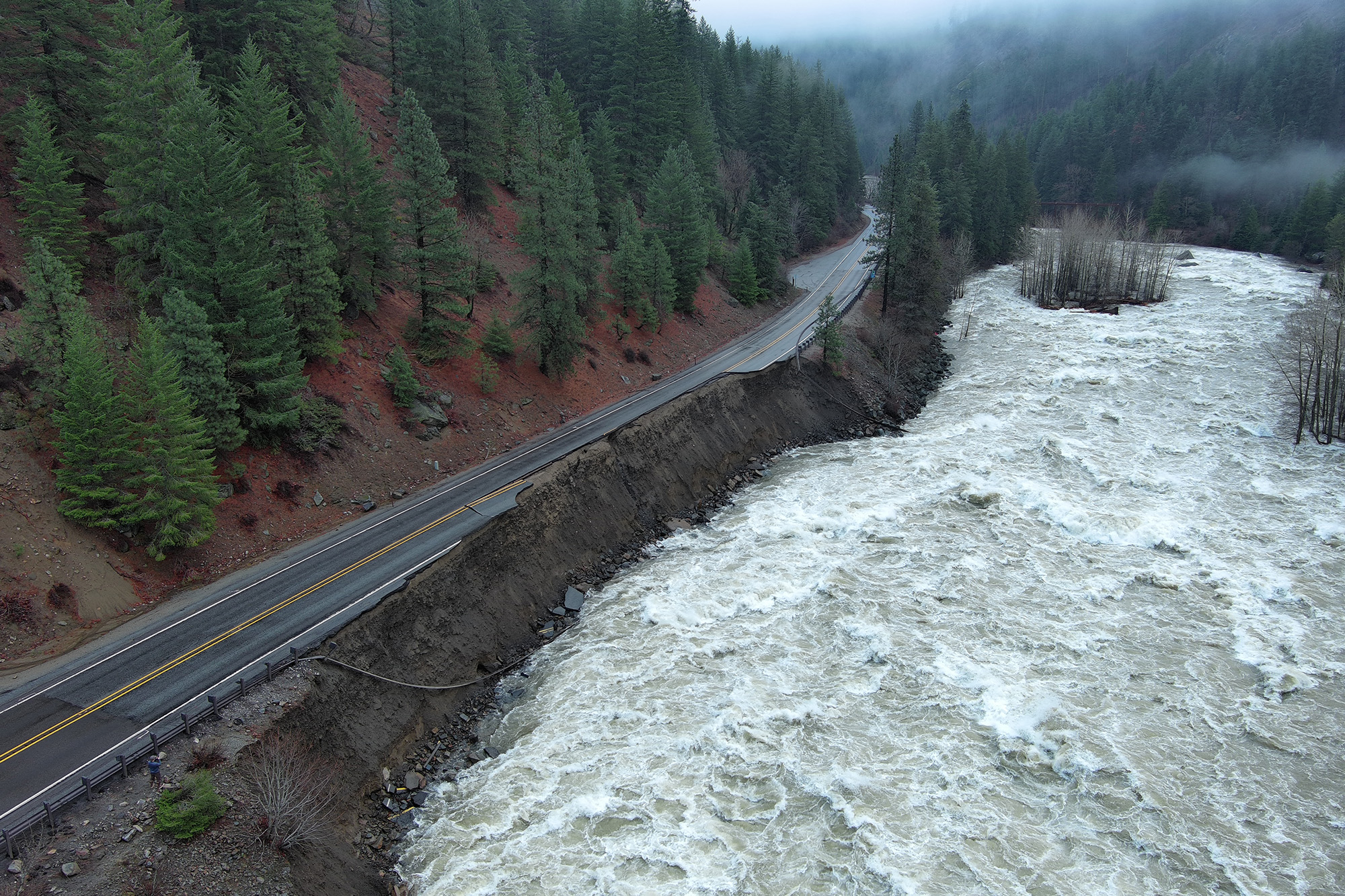
Unlike snow, which acts as a natural "water tower" that releases its cargo slowly over the summer months, rain runs off the mountains immediately. This creates a double-edged crisis: winter flooding and summer scarcity. In December 2025, a massive rain-on-snow event near Stevens Pass caused a catastrophic flood that washed away sections of Highway 2, disrupting regional commerce for months.
Data Analysis: The Shrinking "Water Tower"
Supporting data from recent academic studies highlights the gravity of the situation. A 2021 review published in the journal Nature warned that the Western United States could lose approximately 25 percent of its historical mountain snowpack within the next 25 years. The study indicates that if global warming continues at its current trajectory, many regions that currently rely on snowmelt will transition to rain-dominant systems by the middle of the century.
This shift has profound economic implications:
- Agriculture: The Central Valley of California and the Yakima Valley in Washington rely on predictable snowmelt to irrigate billions of dollars worth of produce.
- Hydroelectric Power: Dams on the Columbia and Colorado rivers require steady flows to generate electricity. Early runoff means reservoirs may have to release water during the winter to prevent overtopping, leaving them empty by the time peak electricity demand hits in the summer.
- Wildfire Risk: A dwindling snowpack leads to drier forests and soils earlier in the season. The 2026 snow drought has already prompted fire agencies to predict an elongated and more intense wildfire season across the Pacific Northwest and the Rocky Mountains.
Reactions from the Field and Official Responses
Government officials and hydrologists are increasingly vocal about the need for adaptive management. "Some of the courses that were established a hundred-plus years ago used to get more consistent snowpack," Rodgers noted during his survey. "When we measure it now, we don’t know for sure what we’re going to find on the ground when we get there."
The USDA and state water departments are responding by investing in "Forecast-Informed Reservoir Operations" (FIRO). This strategy uses real-time snow data from Church Samplers and SNOTEL stations, combined with advanced weather modeling, to decide exactly when to hold water and when to release it. However, officials warn that technology can only do so much if the primary source of storage—the snow itself—continues to diminish.
Environmental advocates have also pointed to the 2026 data as a "clarion call" for more aggressive climate action. They argue that the infrastructure of the West was built for a climate that no longer exists, and that the "humble tube" used by Rodgers is now measuring the gradual disappearance of a vital resource.
Broader Impact: A Global Legacy
While the Church Sampler was born in the Sierra Nevada, its impact is global. The "Nevada Method" of snow surveying was exported to the Andes, the Himalayas, and the Alps. It remains the primary tool for ground-truthing in international snow science, proving that sometimes the most effective solution to a complex problem is a simple, well-calibrated physical measurement.
As the West navigates a future defined by uncertainty, the legacy of James Church and the ongoing efforts of hydrologists like Toby Rodgers remain indispensable. The Church Sampler provides the raw data that fuels the region’s most critical decisions. In a world of shifting climates and "predictably unpredictable" winters, the act of trudging into the mountains to weigh a core of snow is more than just a scientific task; it is a vital act of resource preservation for a thirsty civilization.
The story of the Church Sampler is a reminder that while high-tech solutions like satellites and AI are essential for the future, they must be anchored by the "ground truth" of manual observation. As the snowpack of the West continues to face unprecedented pressure, the data collected in these long aluminum tubes will determine the survival of the landscapes and communities that depend on the mountains for their lifeblood.


