Tag Bay Area Weather

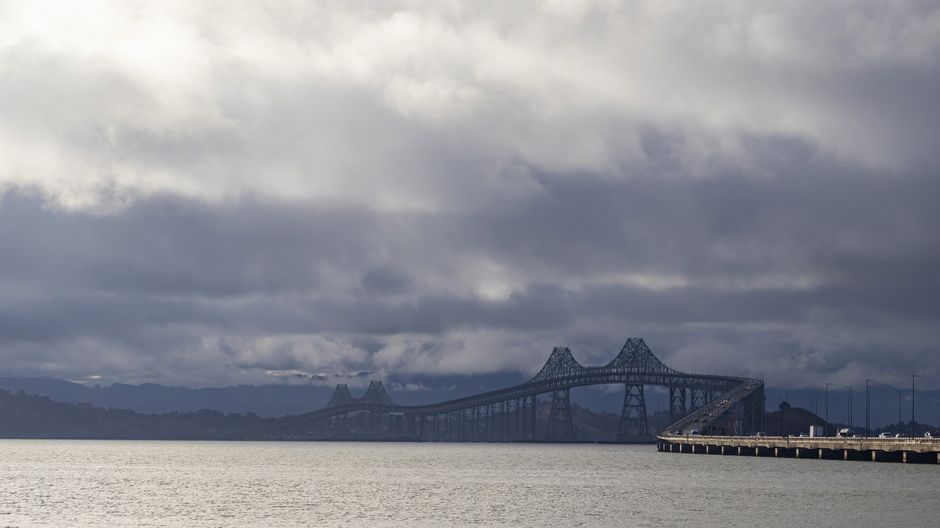
Tag Bay Area Weather: A Comprehensive Overview of Climatic Patterns, Microclimates, and Influencing Factors
The San Francisco Bay Area, a dynamic and diverse region in Northern California, experiences a complex and varied weather system shaped by a confluence of geographical, oceanic, and atmospheric forces. Its proximity to the Pacific Ocean, the presence of significant mountain ranges, and the influence of prevailing westerly winds create a tapestry of distinct microclimates that significantly impact daily life, agriculture, and tourism. Understanding these intricate weather patterns is crucial for residents, businesses, and visitors alike, enabling informed decision-making regarding everything from daily attire to long-term planning. This article provides an in-depth exploration of Bay Area weather, delving into its overarching climatic characteristics, the nuances of its microclimates, and the key factors that govern its atmospheric behavior.
The defining characteristic of Bay Area weather is its Mediterranean climate, a designation shared with other regions like Southern Europe, parts of Australia, and Chile. This climate is primarily defined by mild, wet winters and warm, dry summers. However, this broad classification only scratches the surface of the intricate variations experienced across the region. The Pacific Ocean acts as a powerful moderating influence, tempering extreme temperatures that might otherwise be expected at this latitude. The vast body of water absorbs heat during the summer months and releases it slowly during the winter, preventing the scorching heat and deep freezes common in continental interiors. This oceanic influence also contributes to the characteristic summer fog that often blankets coastal areas and creeps inland.
One of the most prominent features of Bay Area weather is the ubiquitous summer fog. This phenomenon is a direct result of the interaction between cool, moist air from the Pacific Ocean and the warmer landmass. As the warm air over the land rises, it draws in the cooler, denser marine layer. When this moist air encounters the cooler temperatures at higher altitudes or the chill of the land itself, the water vapor condenses, forming fog. The fog’s density and extent vary considerably, often being thickest along the immediate coast and dissipating as it moves inland. This marine layer significantly moderates coastal temperatures, keeping them cool and pleasant even on the hottest inland days. Cities like San Francisco and Oakland are heavily influenced by this fog, experiencing cooler summers with frequent overcast skies and limited direct sunshine. Conversely, inland areas like Concord and Livermore bake in much hotter, drier conditions, often with clear, sunny skies throughout the summer.
The topography of the Bay Area plays a critical role in shaping its microclimates. The coastal mountain ranges, such as the Santa Cruz Mountains to the south and the Mayacamas Mountains to the north, create rain shadows and channel air currents, leading to dramatic temperature and precipitation differences over short distances. For instance, the western slopes of these mountains, facing the ocean, tend to be wetter and cooler due to orographic lift, where moist air is forced upward and cools, leading to precipitation. The leeward sides, or rain shadows, are significantly drier. Similarly, the Diablo Range to the east creates a rain shadow effect for the eastern portions of Alameda and Contra Costa counties, contributing to their hotter and drier summers.
The San Francisco Bay itself is another significant microclimatic influencer. The vast expanse of water acts as a thermal regulator, cooling the surrounding air in the summer and warming it in the winter. This leads to a noticeable temperature gradient across the region. Coastal areas directly bordering the bay, such as Sausalito and Tiburon, benefit from this moderating effect, experiencing milder temperatures than inland locations. However, the bay also plays a role in directing wind patterns. The "delta breeze," a phenomenon where cooler air from the Pacific flows through the Golden Gate and across the bay, can bring refreshing breezes to inland areas during hot summer days. This breeze is a critical factor in moderating temperatures in cities like Berkeley and Richmond.
Wind patterns are a cornerstone of Bay Area weather. The prevailing westerly winds, driven by the larger Pacific High-pressure system, are a dominant force. These winds are responsible for bringing in the marine layer and influencing temperature distribution. The funneling effect of the Golden Gate Strait can intensify these winds, making areas like the Marin Headlands and the western parts of San Francisco notably breezy. This wind can be a welcome relief during warm weather but can also contribute to cooler, more exposed conditions. In contrast, sheltered valleys and inland areas often experience much calmer conditions, with less pronounced wind.
Seasonal variations in the Bay Area are distinct and predictable. Winter (December-February) is characterized by cooler temperatures and the highest likelihood of precipitation. While not as harsh as in many other parts of the country, winter brings rain, often in the form of atmospheric rivers that can deliver significant rainfall over short periods. Temperatures typically range from the low 40s to the mid-60s Fahrenheit. Snow is extremely rare in the immediate Bay Area, though it can be observed in the higher elevations of the surrounding mountain ranges. The winter months are crucial for replenishing reservoirs and providing water for the region’s agricultural and ecological needs.
Spring (March-May) marks a transition period. Temperatures begin to rise, and precipitation gradually decreases. The marine layer can still be a significant factor, particularly in coastal areas, leading to "May gray" and "June gloom," periods of persistent fog and overcast skies that can delay the onset of truly warm weather. Inland areas typically experience sunnier and warmer conditions earlier in the spring. This is a period of vibrant greenery, especially after a wet winter.
Summer (June-August) is typically the warmest and driest season, particularly in inland areas. Coastal regions, however, often remain cool and foggy due to the persistent marine layer. The temperature difference between the coast and the interior can be substantial, often exceeding 20-30 degrees Fahrenheit on a given day. This stark contrast is a hallmark of Bay Area summer weather. The lack of rainfall during this period puts a premium on water conservation.
Autumn (September-November) is often considered the most pleasant season in much of the Bay Area. The marine layer typically retreats, allowing for warm, sunny days with significantly less fog. This period, often referred to as "Indian summer," can bring some of the warmest temperatures of the year, especially in inland valleys. Precipitation begins to increase again towards the end of the season as the Pacific storm track shifts southward.
The influence of El Niño and La Niña, phases of the El Niño-Southern Oscillation (ENSO) cycle, can also significantly impact Bay Area weather, particularly rainfall patterns. El Niño events are often associated with increased precipitation across California, potentially leading to heavier winter storms and a reduced risk of drought. Conversely, La Niña events can lead to drier conditions, exacerbating drought concerns. These teleconnections highlight the interconnectedness of global weather patterns and their regional manifestations.
In terms of specific meteorological phenomena, the Bay Area is generally spared from extreme weather events like hurricanes or tornadoes. However, other hazards exist. Wildfires, particularly during the dry summer and autumn months, pose a significant threat, especially in the wildland-urban interface surrounding the region. Dry vegetation, coupled with strong winds (such as the infamous Diablo winds, hot and dry offshore winds that can fan flames), can lead to rapid fire spread and pose a serious risk to communities. Heatwaves, while less common than in more southern desert regions, can occur, particularly in inland areas during the summer, posing a risk to vulnerable populations. Flooding can occur during periods of intense rainfall, especially in low-lying coastal areas or areas with inadequate drainage. Earthquakes, while not directly a weather phenomenon, are a significant geological hazard for the region and can have secondary impacts, such as fires from damaged gas lines or disruption of essential services, indirectly affecting how people cope with weather.
For practical purposes, understanding the specific microclimate of one’s location within the Bay Area is paramount. A quick drive of just a few miles can reveal significant differences in temperature, fog cover, and wind. This necessitates a nuanced approach to weather forecasting and preparedness. Residents often speak of "San Francisco weather" versus "East Bay weather" or "South Bay weather," acknowledging these distinct climatic zones.
In conclusion, Bay Area weather is a sophisticated interplay of oceanic moderation, topographic influences, prevailing wind patterns, and seasonal cycles. While generally characterized by a Mediterranean climate, the region’s intricate geography gives rise to a fascinating array of microclimates, from the foggy, cool coast to the hot, dry inland valleys. The persistent influence of the Pacific Ocean, the channeling effects of mountain ranges, and the dynamic nature of the bay itself all contribute to this unique climatic tapestry. A comprehensive understanding of these factors is essential for navigating the daily weather and appreciating the diverse environmental conditions that define this vibrant part of California.


