The Silent Collapse: How Climate Change is Turning the Himalayas into a Landscape of Unpredictable Peril

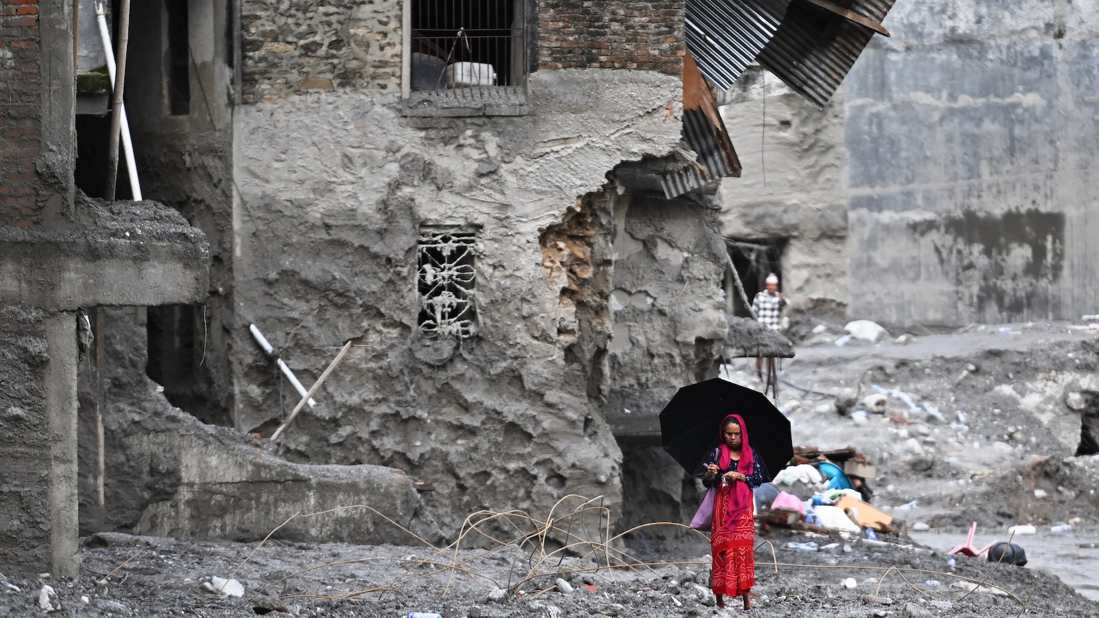
On August 26, a catastrophic geological event unfolded near the border between Nepal and Tibet, marking one of the most significant natural disasters in the region’s modern history. A massive section of a mountain slope succumbed to gravity, triggered by the destabilizing effects of a warming climate. An estimated seven billion cubic feet of glacial ice and rock—a volume sufficient to fill 100 football stadiums—detached from the peaks and plummeted nearly a mile in a vertical drop into the river basin below. The impact generated a violent, slurry-like surge of water and debris that roared through the valley at speeds reaching 100 miles per hour. The resulting wall of mud and rock obliterated downstream villages, leaving more than 1,300 people confirmed dead and thousands more reported missing, as rescue operations continue to struggle against the treacherous, unstable terrain.
A Chronology of the Disaster
The collapse did not occur in a vacuum; it was the culmination of long-term environmental degradation exacerbated by rising global temperatures. While the catastrophic failure happened on August 26, retrospective analysis of satellite data from the NISAR mission—a joint project between NASA and the Indian Space Research Organisation—reveals that the mountain slope had been exhibiting signs of instability for weeks. Subtle shifts in the surface, detected by the satellite’s advanced radar sensors, indicated that the bedrock was losing its integrity.
By the time the final fracture occurred, the volume of material displaced was unprecedented. The sheer kinetic energy of the impact created a seismic event so powerful that sensors as far away as Alaska recorded the tremors, initially leading global monitoring agencies to misidentify the source as a 5.2 magnitude earthquake. This confusion highlights a critical gap in international monitoring: the distinction between tectonic activity and massive surface-level slope failures remains blurred in remote, high-altitude regions.
The Science of Destabilization
The Himalayas, often referred to as the "Third Pole," hold the largest reservoir of ice outside the polar regions. However, these mountains are warming at a rate faster than the global average. The core issue, according to glaciologists like Mark Carey of the University of Oregon, is that glaciers serve as the "glue" for mountain infrastructure. As they retreat, they expose previously frozen silt and rock that have not been reinforced by long-term geological pressure.
This process is multifaceted:
- Permafrost Thaw: The frozen soil, or permafrost, that locks mountain slopes together is melting. When temperatures rise, this natural cement softens, making the steep terrain prone to sudden, large-scale slumping.
- Hydraulic Fracturing: As glacial ice melts, the resulting water penetrates cracks in the bedrock. During the day, it exerts pressure; at night, if it refreezes, the expansion of ice acts like a wedge, slowly prying apart the rock face over decades.
- Moraine Breaching: Retreating glaciers leave behind large ridges of loose debris known as moraines. These natural dams, often unstable, hold back massive quantities of glacial meltwater. If a landslide hits one of these lakes, the resulting "seiche" or wave can cause the dam to fail, sending a wall of water downstream—a phenomenon known as a Glacial Lake Outburst Flood (GLOF).
Comparative Analysis: Successes and Systemic Failures
The tragedy in Nepal contrasts sharply with other regions that have successfully mitigated similar risks. In Juneau, Alaska, the Suicide Basin presents a recurring threat of flooding. However, due to rigorous, real-time monitoring—including laser elevation sensors, high-definition cameras, and drone-based volumetric mapping—authorities can provide ample warning to residents. When the basin reaches a critical threshold, a community-wide alert system triggers, ensuring that residents move to higher ground long before the water reaches inhabited areas.
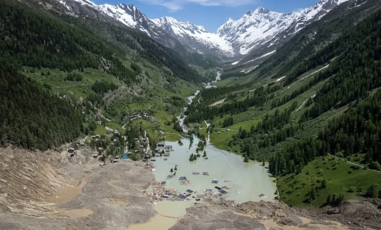
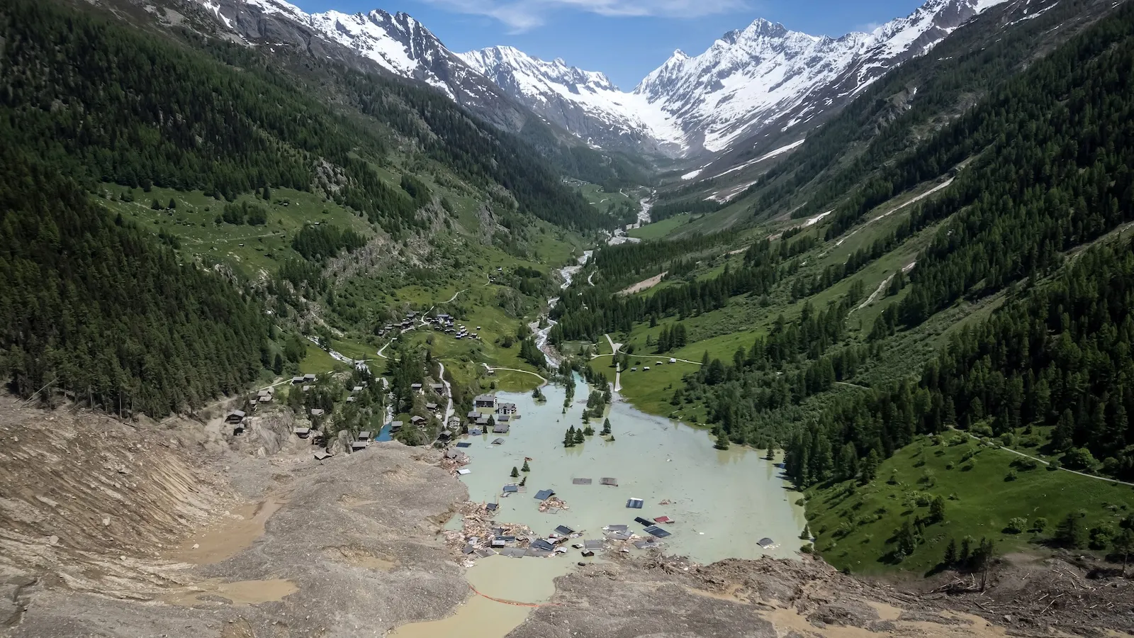
Similarly, in Peru, decades of proactive engineering have involved the controlled draining of high-risk glacial lakes. These interventions have saved thousands of lives. In Switzerland, authorities recently demonstrated the power of early warning when they successfully evacuated 300 residents from the village of Blatten days before a massive landslide engulfed the area.
The fundamental difference, as noted by researchers like Eran Hood, is the density of monitoring infrastructure. The Himalayas cover a vast, rugged, and often inaccessible expanse. Establishing a comprehensive, sensor-based early warning system for every high-risk slope in the region is a logistical and economic challenge that currently exceeds the capacity of local governments.
The Role of Emerging Technology
To combat this, the scientific community is looking toward "repurposed" technology. Seismic networks, originally designed to detect earthquakes, are being recalibrated to identify the specific frequency signatures of ice-and-rock avalanches. The success of this approach was evidenced during the August 26 disaster: while the primary collapse was not prevented, the seismic signature reached a school downstream minutes before the debris wave arrived. This critical window allowed a local principal to evacuate 900 students, an act that saved hundreds of lives and proved that even a few minutes of warning can be the difference between tragedy and survival.
Furthermore, fiber-optic sensing is emerging as a frontier in glaciology. By burying cables across the surface of glaciers, scientists can detect "icequakes"—micro-fractures in the ice that serve as an early warning for total structural failure. Coupled with data from satellites like NISAR, which can see through the thickest cloud cover to monitor surface deformation, researchers hope to create a multi-layered defense system.
Broader Implications and Future Outlook
The global context of this disaster is grim. Over the last century, the world’s glaciers have shrunk by roughly 20 percent, and projections suggest a further 25 percent loss by the year 2100. Each fraction of a degree in global warming accelerates this decline, leading to hundreds of billions of tons of ice lost annually.
The environmental reality is that many of the world’s mountain ranges are approaching a "tipping point." For many slopes, stability is a binary state: frozen or unfrozen. As the threshold of the freezing point is crossed, the structural integrity of these landscapes will continue to degrade, making events like the Nepal collapse not just possible, but statistically probable.
"We are dealing with a changing physical reality," says Dr. Dan McGrath of Colorado State University. "The engineering solutions we have in the Andes or the Alps are vital, but they are localized. We are seeing a planetary shift where the mountains themselves are becoming active, dynamic, and dangerous in ways that defy our current predictive models."
As the international community grapples with the aftermath of the Nepal disaster, the focus is shifting from reactive disaster management to proactive, technology-driven surveillance. Yet, experts warn that technology alone is not a panacea. Without global efforts to mitigate the climate warming that drives this destabilization, the frequency of these "unpredictable" events will likely rise, testing the limits of human resilience in the shadow of a melting world. The tragedy in Nepal stands as a sobering reminder: as the ice recedes, the risks do not disappear—they simply change, often with lethal consequences for those living in the valleys below.