The Warming Pacific: How an Unprecedented El Niño is Reshaping Global Weather and Shattering Records



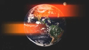
Off the Pacific coast of South America, a monumental shift in the Earth’s climate system is currently underway. A massive band of warm water, known as El Niño, has mutated into a meteorological phenomenon of historic proportions. With sea surface temperatures currently hovering more than 3 degrees Celsius above the historical average, this event stands as the warmest El Niño recorded since satellite monitoring began fifty years ago. Experts indicate that the phenomenon has not yet reached its zenith, with projections suggesting it could climb to 4 degrees Celsius above the norm by November or December.
"This event is already in record territory," said Zeke Hausfather, a climate scientist at the research group Berkeley Earth. "And every model expects it to keep growing." This trajectory has placed global meteorologists on high alert, as the ripple effects of such anomalous heat are already manifesting in contradictory and destructive patterns across the Americas.
A Tale of Two Oceans: The Atlantic Stagnation
While the Pacific is experiencing a period of intense volatility, the Atlantic hurricane season, which traditionally hits its stride between August and October, has remained eerily dormant. By late September, the Atlantic basin usually records roughly four hurricanes, two of which are typically categorized as major storms. However, as of late September, the basin has failed to produce even a single hurricane, shattering the previous record for the latest onset of the first hurricane, which stood at September 11.
The inverse relationship between the Pacific and Atlantic is not coincidental; it is a direct consequence of the atmospheric dynamics fueled by this super El Niño. Hurricanes require a specific "engine" to function: warm ocean water as fuel, high humidity, and, crucially, low wind shear. While the Atlantic is currently saturated with warm water that should theoretically feed cyclone formation, the intense El Niño is generating significant wind shear—discordant air currents moving at different speeds and directions at varying altitudes—across the region.
"Hurricanes do not like that," explains Brian McNoldy, a senior research associate at the University of Miami. "If any manage to form, it can limit how strong they get or how long they live. But so far, it has managed to suppress anything from even forming in the deep tropics." Beyond the wind shear, the event is spawning plumes of dry, sinking air that inhibit the moisture-laden environment necessary for storm development.
The Pacific Crisis: Rapid Intensification and Landfall
While the Atlantic remains suppressed, the Pacific side of the Americas is facing the sharp end of the climate crisis. Hurricane Polo, which recently intensified from a tropical storm to a Category 5 hurricane in less than 24 hours, serves as a stark example of "rapid intensification." This phenomenon, characterized by an increase in sustained wind speeds of at least 35 mph within a single day, is becoming increasingly frequent as oceanic heat content rises.
Polo’s trajectory toward Baja California, Mexico, highlights the vulnerability of coastal regions to these fueled-up storms. Simultaneously, Tropical Storm Nolo has developed into a hurricane, posing a significant threat to Hawaii with projections of heavy rainfall reaching several feet. The combination of anthropogenically warmed oceans and the thermal boost provided by El Niño is creating a "perfect storm" scenario for these coastal regions, where infrastructure is often not designed to withstand such rapid and intense atmospheric energy release.
Global Implications: Heat, Drought, and Economic Stability
The thermal energy transferred from the ocean to the atmosphere during an El Niño event of this magnitude is staggering. Scientists from the Impact Lab have projected that in the first nine months of this specific event, excess heat could be linked to approximately 451,000 deaths globally.
Beyond direct mortality, the shifting weather patterns are expected to cause severe economic disruption. Historical data on previous strong El Niño events show a pattern of "boom and bust" in rainfall: California and the U.S. Southwest often see increased precipitation, while Southeast Asia, the Amazon rainforest, and large swaths of Africa face severe, prolonged droughts. "It is crop failures in those regions that, at least historically, have driven the biggest economic and human impacts of these events," Hausfather noted.
The fragility of global food security is a primary concern for international policy makers. Subsistence farmers in drought-stricken regions are at the highest risk, as their livelihoods are tied directly to the success of a single harvest. The loss of such crops threatens not only the local food supply but also the economic stability of nations that rely on agricultural exports.
The Scientific Context: Why 3 Degrees Matters
To the layperson, a shift of three or four degrees Celsius may appear negligible, but in the context of oceanography, it represents a profound shift in energy. The ocean possesses a thermal capacity 1,000 times greater than the atmosphere, meaning it acts as the primary heat sink for the planet.
"Those are actually really big changes for the ocean," explains Art Miller, a climate scientist at the Scripps Institution of Oceanography. "The ocean has a lot of heat content… so slight changes in the ocean surface temperatures can actually do a lot for the atmosphere."
This event is serving as a chilling preview of the mid-21st-century climate. While global temperatures are expected to moderate once this El Niño wanes, the "baseline" temperature of the planet is steadily rising. Within two decades, researchers anticipate that future El Niño events will be layered atop a much hotter baseline, leading to impacts that could dwarf the current crisis.
Mitigation and Policy Responses
Governments are currently under immense pressure to develop adaptive strategies. The primary focus for many, particularly in the agricultural sector, is the development of financial safety nets. This includes the implementation of robust crop insurance, the creation of national food stockpiles, and the establishment of cash-transfer programs to support farmers during periods of total crop failure.
Fire prevention has also moved to the forefront of the policy agenda. As the combination of drought and heat turns vast landscapes into tinderboxes, officials are calling for more aggressive vegetation management. This includes controlled burns, which, while controversial, are essential for clearing dead biomass that fuels catastrophic wildfires. Furthermore, there is an urgent call to restrict agricultural waste burning and to increase investment in firefighting training and equipment.
Ultimately, the current situation is a sobering reminder that these extreme weather events are occurring on a planet that is fundamentally warmer than it was a century ago. "Everything is happening on a baseline that’s much hotter than it was a century ago, which makes these impacts correspondingly more severe," Hausfather concluded. "It’s a little glimpse of what the planetary climate will look like."
As the world continues to navigate the complexities of this record-breaking El Niño, the international community faces a dual challenge: addressing the immediate humanitarian and economic fallout while simultaneously accelerating the long-term transition to a more resilient, climate-stable global infrastructure. The events of this year are no longer just meteorological outliers; they are a clear indication of the new, more volatile reality that humanity must learn to manage.
Related posts: