Update The Greater Lake Tahoe Area Placed Under A Lake Wind Advisory Until Wednesday Night

Lake Tahoe Area Under Wind Advisory Until Wednesday Night: What You Need to Know
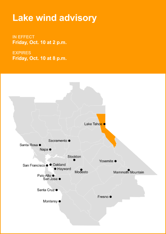
The Greater Lake Tahoe Area has been placed under a Lake Wind Advisory, a critical weather alert issued by the National Weather Service, signaling potentially hazardous conditions on and around the lake. This advisory is set to remain in effect until Wednesday night, prompting caution for all residents, visitors, and those involved in maritime activities. The primary concern is the expected increase in wind speeds, which can significantly impact boating, recreational watercraft, and even shoreline infrastructure. Understanding the specifics of this advisory, its potential consequences, and the recommended safety precautions is paramount for navigating this period safely and effectively.
The National Weather Service’s Lake Wind Advisory is not a minor forecast; it signifies conditions that can pose a direct threat to life and property. For Lake Tahoe, this typically means sustained winds of 20-30 mph with gusts potentially reaching 40-50 mph. These wind speeds are sufficient to generate significant wave action, turning what might appear to be a calm lake into a turbulent and dangerous environment. The advisory period, extending through Wednesday night, indicates a prolonged period of elevated wind activity, meaning conditions are unlikely to improve rapidly and may even persist or intensify before subsiding. This extended duration necessitates ongoing vigilance and adherence to safety protocols throughout the advisory’s timeframe.
The impact of these predicted wind speeds on Lake Tahoe is multifaceted. For recreational boaters, this translates to a heightened risk of capsizing, swamping, and loss of control. Smaller vessels, in particular, are extremely vulnerable to choppy waters and sudden gusts. Larger boats are not immune; even they can experience significant strain on moorings and may face difficulties docking or navigating in rough conditions. The increased wave height generated by sustained winds can also make launching and retrieving boats from trailers a challenging and potentially hazardous endeavor. Boaters are strongly advised to check the latest marine forecasts before heading out and to be prepared to postpone or cancel their plans if conditions are deemed unsafe. Familiarity with emergency procedures and having fully charged communication devices onboard are no longer optional but essential.
Beyond the immediate concerns for mariners, the elevated winds associated with a Lake Wind Advisory can have broader implications for the entire Tahoe basin. Shoreline areas can experience increased erosion, particularly in locations with softer soil or less robust vegetation. This erosion can lead to damage to beaches, docks, and other waterfront structures. Debris, such as fallen branches or unattended items near the shore, can be swept into the lake, posing additional navigational hazards and contributing to pollution. For those residing in areas directly adjacent to the lake, securing loose objects that could be blown around by strong winds is a crucial preventative measure to avoid property damage and potential injury.
Travel in and around the Lake Tahoe area may also be affected by the wind advisory, though indirectly. While the advisory specifically targets lake conditions, strong gusts can sometimes impact exposed roadways, especially those that run parallel to the shoreline or traverse mountain passes. Drivers should exercise caution, particularly when encountering large vehicles or high-profile campers, as crosswinds can pose a steering challenge. Visibility can also be reduced due to blowing dust or spray from the lake, further necessitating attentive driving. While not the primary focus of the advisory, it’s a factor to consider when planning any transit through the region during this period.
The issuance of a Lake Wind Advisory serves as a crucial warning system, enabling individuals and authorities to prepare and respond proactively. Local emergency services and lake patrol agencies will likely increase their monitoring of lake conditions and may implement restrictions on certain waterways or activities if conditions become sufficiently dangerous. Understanding the terminology used by the National Weather Service is vital. A Lake Wind Advisory is a step below a Gale Warning or Storm Warning, but it still signifies conditions that warrant significant caution. These advisories are based on sophisticated meteorological modeling and real-time observations, making them reliable indicators of approaching hazardous weather.
For those planning activities on Lake Tahoe, especially water sports like paddleboarding, kayaking, or jet skiing, the wind advisory necessitates a serious re-evaluation of plans. These activities are inherently more susceptible to wind conditions than larger, more stable vessels. Even experienced participants can find themselves in precarious situations when winds pick up unexpectedly. It is always prudent to err on the side of caution. If there is any doubt about the safety of venturing onto the water, postponing the activity is the wisest course of action.
The economic implications of a wind advisory can also be felt in the Tahoe region. Businesses that rely on lake tourism, such as marinas, boat rental companies, and charter services, may experience cancellations or reduced patronage during the advisory period. While this can be a financial setback for these enterprises, the primary objective of these advisories is the preservation of life and property, which overrides short-term economic concerns. Visitors who have planned a trip centered around water activities might need to adjust their itineraries, perhaps focusing on hiking, dining, or exploring the numerous attractions available at higher elevations that are less directly impacted by lake winds.
Understanding the meteorological factors that contribute to a Lake Wind Advisory is also beneficial. Typically, these advisories are triggered by significant pressure gradients – differences in atmospheric pressure over a given area. Stronger gradients lead to faster air movement, or wind. In the Tahoe basin, this can be influenced by weather systems moving across the Western United States, the passage of cold fronts, or even localized thermal effects. The complex topography of the Sierra Nevada mountains can also channel and amplify winds, making certain areas of the lake more susceptible to higher gusts than others.
Preparation is key when a Lake Wind Advisory is in effect. For boat owners, this means ensuring their vessels are securely docked or moored. This might involve checking lines, adding extra fenders, or even moving boats to more protected harbor areas if available. For those who store their boats on trailers, securing the trailer itself to prevent it from being blown away is also important. Any loose items on docks or around waterfront properties should be secured or brought indoors.
For individuals visiting or living in the area, staying informed about the latest weather updates is critical. The National Weather Service website, local news outlets, and weather apps provide real-time information. It is also advisable to have a plan in place for what to do if conditions deteriorate rapidly. This includes knowing evacuation routes if necessary, although a Lake Wind Advisory typically does not necessitate widespread evacuations. The focus is on immediate safety and risk mitigation related to the lake and its immediate surroundings.
The duration of the advisory until Wednesday night suggests a persistent weather pattern. This means that even if the wind momentarily calms, there is a strong likelihood of it picking up again. Therefore, a sustained level of caution is warranted. It is not a situation where one can assume safety once the most intense gusts have passed.
In conclusion, the Lake Wind Advisory for the Greater Lake Tahoe Area is a significant weather alert demanding serious attention. The predicted strong winds and resultant wave action pose substantial risks to boating and other water-based activities, as well as potential impacts on shoreline areas and travel. By understanding the implications of the advisory, staying informed about weather developments, and taking appropriate safety precautions, residents and visitors can navigate this period with the utmost safety and minimize potential hazards. The priority remains the well-being of everyone in the region, and adherence to the guidance provided by the National Weather Service is paramount.


